Code
library(terra)
library(sf)
library(osmdata)
library(ggplot2)library(terra)
library(sf)
library(osmdata)
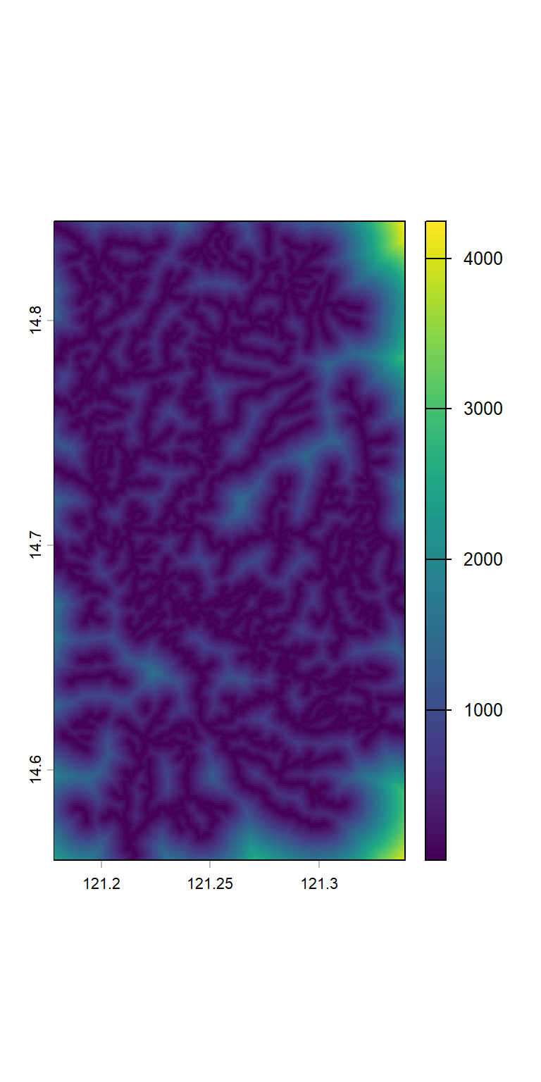
library(ggplot2)Distance to roads was calculated in meters using the OpenStreetMap dataset, including all road types such as footways and paths, and generated at a spatial resolution of 3 arc-seconds.
# get bounding box in the right format
area <- list.files("data/umrbpl/", full.names = TRUE, pattern = "shp$") |>
  read_sf() |>
  st_transform(crs = "EPSG:4326")
umrbpl_bb <- area |>
  ext() |>
  matrix(ncol = 2, byrow = TRUE)
rownames(umrbpl_bb) <- c("x", "y")
colnames(umrbpl_bb) <- c("min", "max")

# download road network from OSM
roads_all <- umrbpl_bb |>
  opq() |>
  add_osm_feature(key = "highway") |>
  osmdata_sf()
roads_all$osm_lines <- subset(roads_all$osm_lines, highway != "residential")

template_raster <- rast("data/srtm/topo_variables.tif")[[1]]
dist_to_roads <- distance(template_raster, roads$osm_lines)
if (!dir.exists("data/osm")) dir.create("data/osm")
writeRaster(dist_to_roads, "data/osm/dist_to_road.tif")"data/osm/dist_to_road.tif" |>
rast() |>
plot()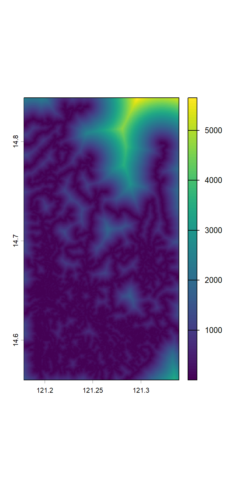
Distance to roads was calculated in meters using the OpenStreetMap dataset, including all road types such as footways and paths, and generated at a spatial resolution of 3 arc-seconds.
# get bounding box in the right format
area <- list.files("data/umrbpl/", full.names = TRUE, pattern = "shp$") |>
  read_sf() |>
  st_transform(crs = "EPSG:4326")
umrbpl_bb <- area |>
  ext() |>
  matrix(ncol = 2, byrow = TRUE)
rownames(umrbpl_bb) <- c("x", "y")
colnames(umrbpl_bb) <- c("min", "max")

# download road network from OSM
water_all <- umrbpl_bb |>
  opq() |>
  add_osm_feature(key = "waterway") |>
  osmdata_sf()

template_raster <- rast("data/srtm/topo_variables.tif")[[1]]
dist_to_water <- distance(template_raster, water_all$osm_lines)
if (!dir.exists("data/osm")) dir.create("data/osm")
writeRaster(dist_to_water, "data/osm/dist_to_water.tif", overwrite = TRUE)"data/osm/dist_to_water.tif" |>
rast() |>
plot()